
Offline Maps
Your route keeps drawing where the signal stops.
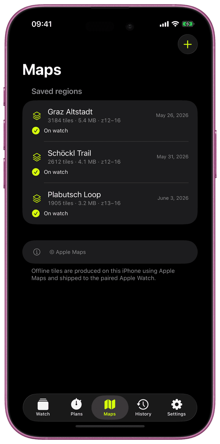
You choose which map areas live on your Apple Watch. On the iPhone, frame an area, say your local trails, a valley you are hiking next weekend or a city you are visiting, and sync it to the watch. Once it is there, that area is available offline: with no signal, in airplane mode, or with the iPhone left at home.
Save as many areas as you like, each with its own name. Planning a new trip? Add another area at any time while your watch is near your iPhone, and it joins the ones already on your wrist.
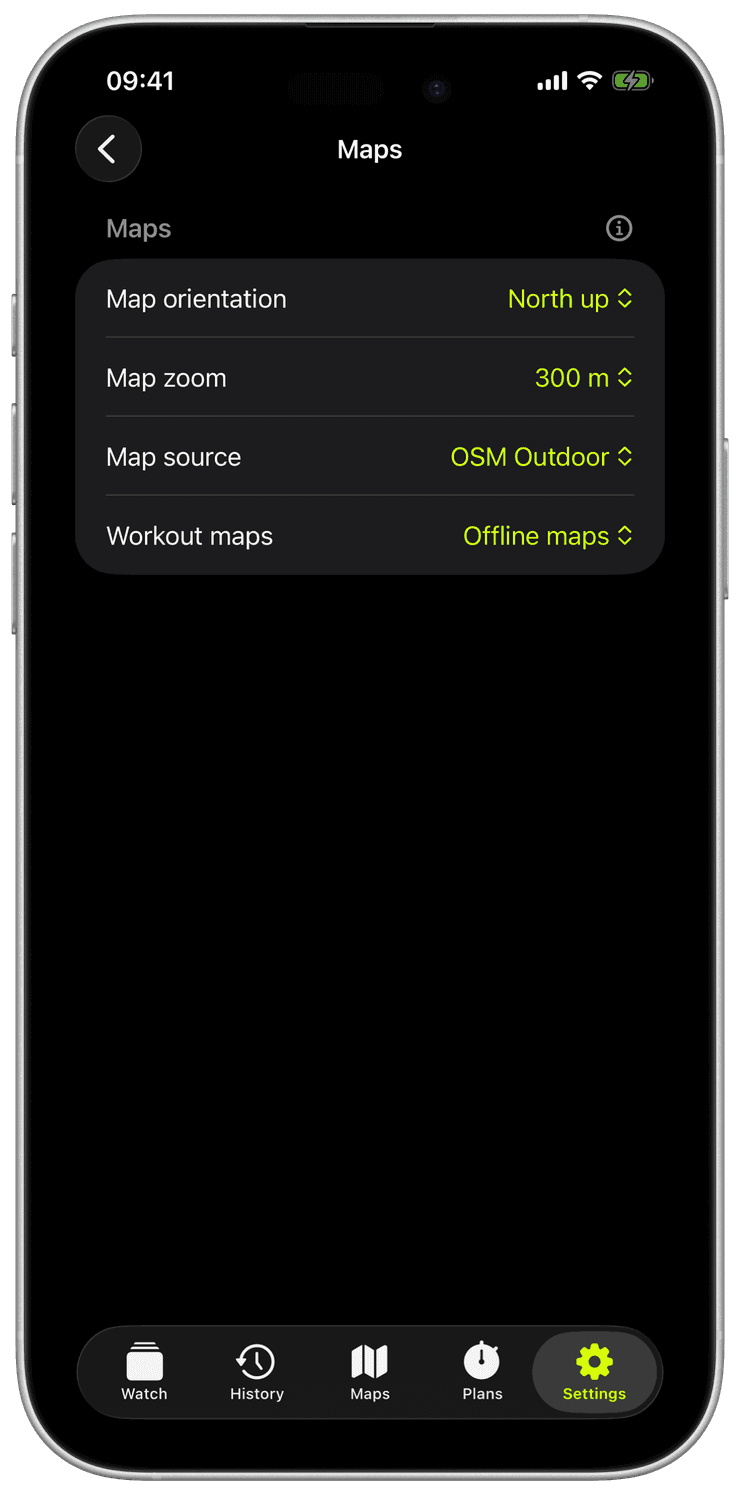
Choose the map style for each area. OSM Outdoor is a trail map with hiking paths, hillshading, peaks and huts. Apple Maps is there too if you prefer it.
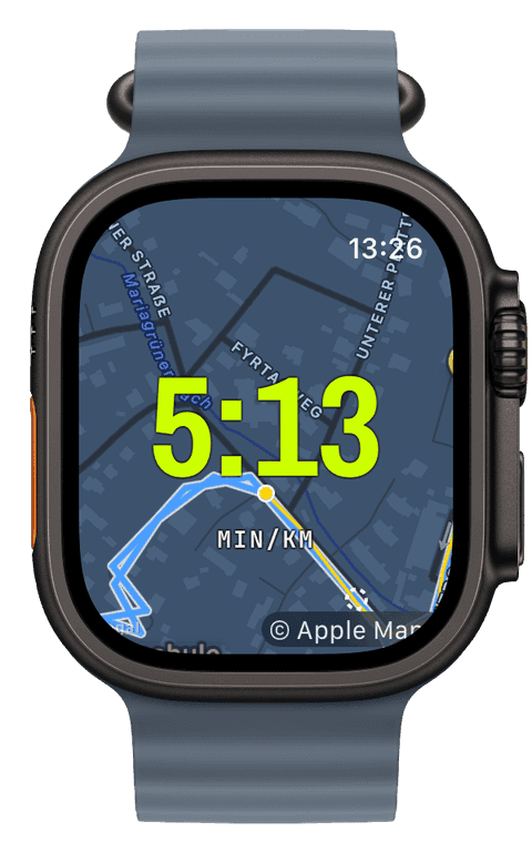
During a workout, the map can fill the whole screen behind your numbers, sit in a small widget, or open full size with a long press. Your route and the path you have covered are drawn on top. Turn on “Map orientation” and the map rotates so the direction you are heading always points up.

In the Maps tab on your iPhone, frame the area you need and pick a map style. You see the download size before you confirm.
Tap export. With your watch near the iPhone, the area syncs straight to it, with no cloud in between. Repeat for every area you want on your wrist.
Add a map to one of your workout screens and head out. Wherever you are inside a saved area, the map works offline, and if the signal drops mid-workout the watch switches to your saved map on its own.
Do offline maps cost extra or need a subscription?
No. Offline maps are part of the one-time unlock, like every other feature. No per-area purchases, no subscription, no account.
Can I keep several areas on the watch?
Yes. Save as many areas as you need and add new ones whenever your watch is near your iPhone, for example the evening before a trip. Each area keeps its name, so you can tell them apart.
How large an area can I save?
Your choice. The export screen shows the size before you confirm, so a short loop and a whole valley are both easy to plan around the storage on your watch.
Does the map work with the iPhone left at home?
Yes. Once saved, the map lives on the watch. No phone nearby, no signal, airplane mode: the map keeps working.
The map that grew a third dimension
Runara now draws its own trail maps from OpenStreetMap data and replays your runs through real 3D terrain and buildings, all rendered on your iPhone. How a privacy-first app ended up with its own planet.
→Live metrics, and maps that work where the signal doesn't
Getting real numbers on the wrist, then teaching the watch to draw a map with no cloud and no signal. Plus the bugs that fought back.
→