
GPX Routes & Navigation
Import a route. The watch keeps you on it.
Bring any GPX file into Runara: through the Maps tab’s import picker, or straight from Mail, Files, or Safari with “Open in Runara”. Routes sync to the watch over the same direct device link as offline maps, no cloud, and you can rename them, resend them, or delete them from the phone. It works the other way too: turn any finished workout into a followable route with “Save as route”, or export its full GPS track as a GPX file to share with other tools.
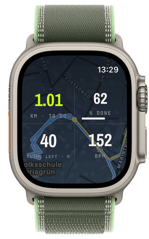
Pick a route when you start any GPS workout and it draws in cool blue under your volt breadcrumb, on the map background, the map widget, and the expanded map, in both the online and the offline renderer. Drift off the track and the watch taps your wrist (with an optional spoken “Off route”) and points a dashed line back to the nearest point of the route; the alert is debounced against GPS noise, so a wobbly signal never nags you.
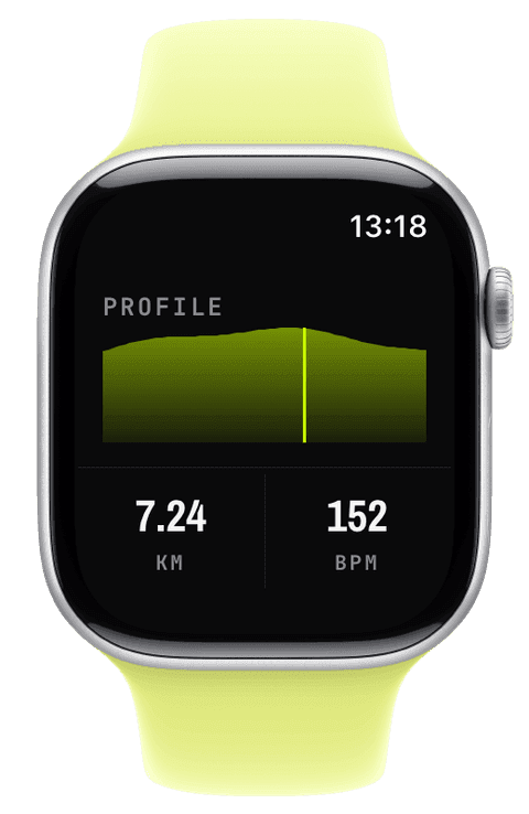
Waypoints from the GPX file come along for the ride, up to fifty per route, rendered as named markers that buzz and announce as you reach them. A route-progress widget shows distance remaining, percent complete, or the ascent still to come, and an elevation-profile widget plots your live position on the planned climb, with the same profile charted in the route’s detail view on iPhone.
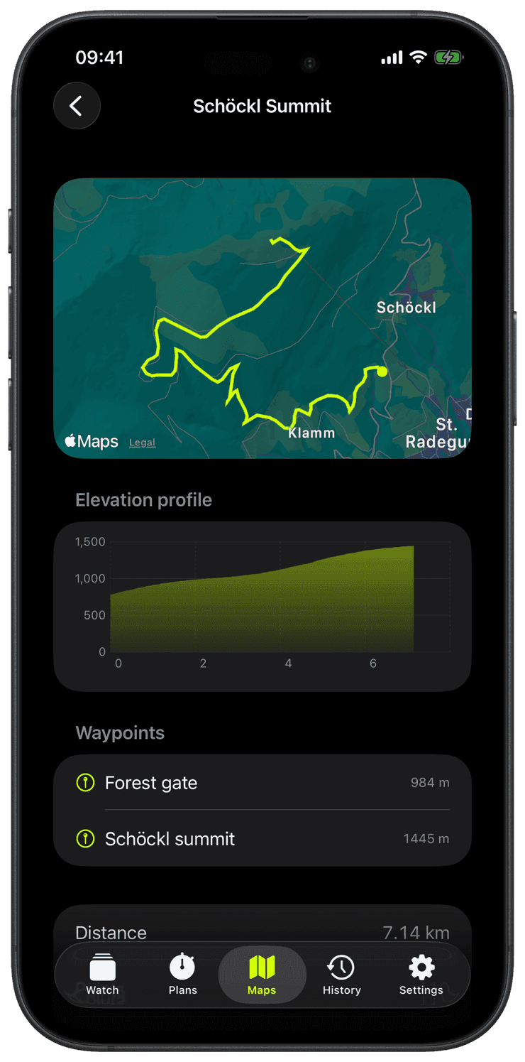
Get a route in: open a GPX from Mail, Files, or Safari with “Open in Runara”, import through the Maps tab, or turn any finished workout into a route with Save as route.
The track is simplified to a clean, watch-friendly line and syncs to the watch with its waypoints, delivery status visible, resend a tap away.
Start any GPS workout and the watch offers your routes; pick one and it draws in blue under your live breadcrumb on every map surface, online or offline.
From there the navigation suite runs by itself: off-route buzz with a dashed pointer back, waypoint arrival announcements, the progress widget with remaining distance and ascent, and the elevation profile with your position on it.
Is this turn-by-turn navigation?
No, and deliberately so. Runara draws the track and tells you when you leave it, geometric guidance that works offline, needs no routing service, and matches how marked trails and planned loops are actually followed. There are no computed turn instructions.
How detailed can a route be?
Tracks are simplified to up to a thousand points, plenty for an ultra course, while staying instant on the watch, and up to fifty waypoints import with their names. Elevation and timestamps survive the round trip when you share a GPX back out.
Will GPS noise trigger false off-route alarms?
The detection is debounced: leaving needs sustained distance from the track over several fixes, returning is confirmed the same way, so tree cover, canyons, and switchbacks do not nag. You feel one honest buzz when it matters.
Can I re-run a past workout as a route?
Yes. Save as route turns any recorded GPS workout into a followable route, and the ghost pacer can then chase a target pace along it, your past self’s course, raced at the pace you choose today.